 |
| Sedona Fairylands & Grand Canyon National Park |
Immersive Road Trip To Sedona Fairylands & Grand Canyon National Park
Use a VR Headset to Transport Yourself on a Road Trip to some Magical Places. First to Noah’s Ark, Vermillion Castle & Hidden Haven Waterfall in Dixie National Forest, then to photographers favorite viewpoints of Cedar Breaks National Monument & Horseshoe Bend. Then we will do a sunrise hike to DevilsBridge that looks like an entrance to a Fairy Kingdom, and then we will head to Fay Trail in the Secret Forest to see something magical. From there we will watch Sunrise over the Grand Canyon in the Spring from the Desert Watchtower. Our last spot will be journeying into the depths of the epic Buckskin Gulch slot canyon to find the Dragon. So what are you waiting for? Grab your VR Headset and transport yourself into this magical road trip with me that is sure to make you smile and give your day a positive boost.
Oculus Quest Headset Links
Direct Link
Oculus Portfolio Link for access to all my VR Nature Vacations
YouTubeVR Links Roadtripping to Sedona's Fairyland & Grand Canyon.
VR 360 Video of Roadtripping to Sedona's Fairylands & Grand Canyon.
If you are not watching in a VR Headset, make sure you move around so you can see everything, or put it in a Google Cardboard and the YouTube Mobile App so you can still be transported there. A Google Cardboard can be purchased for less than $10.
Noah's Ark & Vermillion Castle
This road trip started as me conquering many of my wish list hikes, but like most of my adventures lately, it felt like I was getting help from above to create a theme or lesson from the adventures. This one was just full of delightful seridipities of finding objects, like like Noah's Ark, in nature. I love how Noah's Ark just looks like it is sitting up on top of the Mountain, and how Vermillion Castle looks like a huge Castle Wall. Here is my link to Noah's Ark if you would like to try out this fun trail. The most important thing is to cross the river down lower than the broken bridge where it is shallower, for sure take a buddy on this one, and take hiking sticks to help you with a 3 point system on the steep parts.
Vermillion Castle trail is just across the street and up a about 1/4 mile up the road from Noah's Ark. I like the View of Noah's Ark even better from the Vermillion Castle Trail, but it starts with a very steep switchbacks and the trail is a little tricker to follow. It is also not labeled correctly on Google Maps. I have tried to fix this, but just know Google maps might have it incorrect, and it is just barely up the road from the Noah's Ark Gate for the Trailhead on the opposite side of the road. Here is the the Google map Coordinates. 37.7944315837899, -112.79138708618964
There is a sign there that says Vermillion Castle to verify you are in the correct location.
Here is my recording of my trail hiking Vermillion Castle in Gaia.
 |
Gaia Recording of Hiking Vermillion CastleHidden Haven Waterfall |
 |
| Hidden Haven Waterfall |
Hidden Haven Blog Post
Cedar Breaks National Monument
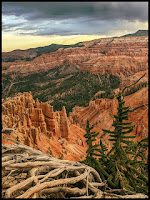
My next stop on my Road Trip was Cedar Breaks National Monument. Cedar Breaks is always a fun quick stop. I love catching views here at sunset or sunrise, and hiking here to the Bartizan Arch is always a favorite trail of mine. I have usually come to Cedar Breaks during the Flower Festival here, but this road trip I was crossing my fingers for that perfect amount of snow here. Just a little snow to compliment the beautiful colors of the orange and green, and I was SO blessed to get my wish. The draw backs this road trip was that it was SUPER windy. Nock you off your feet if you are not careful windy. The benifit is that my cloud time lapse only took a few minutes to get a gorgeous one! LOL. They also have construction going on up there as of middle of May 2022, so many of the spots were unaccessible. If you are interested in chasing this beautiful location here is a map location, and a link to my blog post on that hike.
Map Location
Blog Post on Cedar Breaks and Bartizan Arch.
Catstair Canyons Stacked Cars to Build the Freeway.
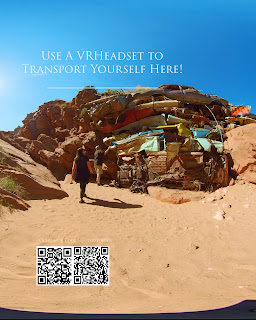
My next stop was to see the Stacked Cars in Catstair Canyon. This is such a funny stop, and it is a little precarious to get here for it is a blind corner so you have to be SUPER careful that you give enough heads up to any cars following you so you don't end up with a pile up, but if you can SAFELY get here, it is kind of a fun hidden secret.
Here are the Google Map Coordinates.
37.127184849796215, -111.96575940211945
You want more info on getting here, here is my blog post.
Next Stop Horse Shoe Bend
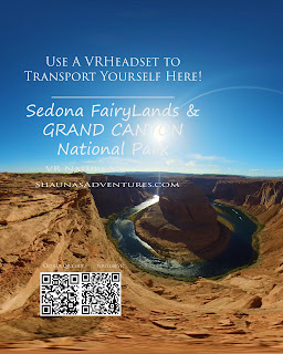
When I think of famous places that photographers love to capture, Horseshoe Bend will always make the top 10. It is funny that this photographers dream spot is not a National Park, but just ran by the city of Page Arizona. They charge a fee to get in in, and often there are more cars then the large parking lot will hold, so they bus people in from a neighboring lot, but if you can be here and not have too large of a crowd it is beautiful. It is only a short 1/2 mile walk from the parking lot, but of course this area can become an oven so if you are dealing with hot weather, pack LOTS of water.
Here is this Map Location if you would like.
Sedona Arizona's Fairylands
So getting to Sedona is a long drive for me, but it has been on my bucket list to get back here for years. I planned different hikes, but somehow the Light Above redirected me to these, and I feel so grateful for it was such a Fairy Tale Adventure. My first hike I was hoping to do guided us to a resort, and not the trailhead. I didn't want to pay for some expensive resort to do the trail, so I went on to the next plan. I had looked into doing DevilsBridge, but my friends Apple phone told her with was permanently closed. I was like...dang. It was SO late when we finally got to Sedona (which is a huge mistake, for the drive into Sedona is magical and a must to do in daylight.), but I decided to just deal with it in the morning. I woke up early hoping and a definite pray in my heart to help me find a beautiful spot for sunrise. I found a place marked Scenic Spot on my Map, and decided to chase that and hope for the best. When I arrived, I walked around with my headlight on, and the map said trail to DevilsBridge....I thought that was funny, for I thought it was close, and I didn't connect that my random scenic spot lead me to the trail I was hoping to do that morning. A car pulled up,and I asked them which trail they were chasing this morning, and they told me DevilsBridge. I asked if it was open, and they said yes, so my first wonder and moment of Gratitufe for me, was that I got to this beautiful spot that feels like an entrance to a Fairy Kindom when I was at first detoured away from it. It does have a very rough road you can drive closer to the trail if you have a great clearance jeep type vehicle, but I also really enjoyed walking the trail at sunrise, for it was beautiful.
My second grateful moment, was that I threw out lots of hike ideas to my friends and they picked the Fay Trail. In my mind, I hadn't even made the connection from Fay to Fae, but when I saw the sign that this was in the Secret Forest, my mind was giddy, and I was SO hoping for a magical moment that fairies could be introduced. Luckily I had a local guide tell me that when you see the End of Trail sign, to hike up the rock about half way and then turn around a look out into the canyon. I was almost in tears of gratitude at how perfect and how maigical the view was. This trip is like so much of my life. I feel like I am trying SO hard to listen and follow the direction I am given from above, but sometimes it is more obvious than others that he is really playing a part in helping those who are trying so hard to gain direction. You let the Light know that you are willing to be His hands, and He finds ways to let your hands create magic!
Sunrise over Grand Canyon in the Spring
I have seen pictures of the Grand Canyon so many times, and even driven by entrances to the Grand Canyon multiple times, but I doubted my 360 camera could capture it, for it struggles with things that are far away. I was SO glad I didn't pass this by this trip. The spring green in the canyon during sunrise was so beautiful. I know my camera didn't do it justice, for I still can't afford a darn Pro 2 camera, but both my little camera and myself really did work hard to get as much beauty as we could here, and I think we did ok. I really did like that I picked the Desert Watch Tower to start sunrise for I really enjoyed the tower in some of the shots. We then wanderd from lookout to lookout. One thing we were a little disappointed in, is that to hike the South Kaibab Trail you either have to park way out on the road and walk an extra mile in, or you need to catch the bus to the trailhead. We got tired of waiting for the bus, and ended up walking, but they don't pick you up once you start walking. I still LOVED hiking into the Grand Canyon to the OohWah point. I think you get this funny mind set that you can't hike the Grand Canyon unless you are heading rim to rim, or Backpacking, but there is NOTHING in any book that says you can't just enjoy a section of a trail. Even though I only did to OohWah point here, I strill thought it was fantastic. By this time I think my hiking on this road trip I was up to about 20 miles in 2 days with all the extra walking I do to film, so I was definitely feeling it, and was eager to save some gas for Buckskin Gulch later in the day.
Last Stop Wire Pass to BuckSkin Gulch
The first time I wenr went to Buckskin Gulch, we walked the mile or so on the Wire Pass Trail to the entrance to Buckskin and we got to the 14 foot drop and Todd had been struggling with foot issues...it was a no to going on. We took a side trail and ended up enjoying some TeePee shapes just off the Wire Pass Trail. They were awesome! While wandering we ran into a Ranger making sure people were not in the Wave without a permit. (We were just outside the border.) I told him about us and others that got discouraged by the 14 foot drop, and begged for him to let me pay for a ladder for the trail. He told me the reason why it wasn't was because they argued it would ruin the natural look of the canyon. I chuckled at him, and said that I am sure creativity you could solve this problem, It wouldn't be that difficult to install a WOOD ladder that still looked natural. I was happily surprised to see pictures a few months later of a wooden Ladder there. When I got to this spot I was excited to see this wooden ladder I saw in the pictures, and I was confused that is was not the same ladder as I saw (Quite sure that one was Lodged in the slot canyon high up a little ways down. LOL) You can tell that they really tried to make an effort to make sure this ladder is securely attached. They have also created an alternate route in now that even if you can't do the 14 foot drop, you could still get in. Just have to watch for the signs. Buckskin Gulch can have some EPIC shots when the walls get skyscraper high. The problem is that is looks so similar for SO long that I think most get bored before getting to the really cool stuf, you might even need to backpack overnight to get to the epic spot I was hopping to find. It still was a super fun adventure, and I learned a interesting thing on this location. We had been hiking for almost 2 hours into Buckskin Gulch and my friends decided they were done. They were getting a little bored of the sameness of the place. I told thim I was going to try and keep going for just 20 more minutes, and then I would be done. I think The Light, knowing I was distracted used my friend to help me. She found the asesome Dragon, and the Mask, and the Monkey here, and they fit so well with my fun theme that I was thrilled! So awesome how Others can be inspired to help and support us on our journey.
Here is a Map Location of the Wire Pass Trailhead.
So if you are searching for a fun road trip, you are welcome to try this one out. It was nice, for there was a nice break every few hours to walk around and see something beautiful. To me those are the best road trips. Sedning you love and postive vibes your way!
- Shauna


Comments
Post a Comment
I would love to hear your thoughts about this area or this post. Feel free to leave a comment here.