CASCADE FALLS DIXIE NATIONAL FOREST
Duck Creek Village Utah in 360 Degrees
 |
| Sun Rays over Cascade Waterfall |
Cascade Falls area in the Dixie National Forest is a fascinating place for behind all the red rock beauty with the green contrast is a dormant volcano and lava field that spreads for miles. Above this waterfall, is Navajo Lake and on the east end by the dam is a sinkhole where the water sinks into a lava tub and travels miles through the earth until is dumps out here at this waterfall. Beautiful and fascinating hike and waterfall. Hiking heals the heart and soul. Get out and get some green time today, but please do it safely.
 |
| Cascade Waterfall Dixie National Forest by Duck Creek Village |
360 Video at Cascade Waterfall
This is a 360 Video so make sure you rotate it around so you can see everything. Of course the best way to watch it is by putting on a VRHeadset and you can transport yourself here using YouTubeVR- ShaunasAdventures. If you like the tiny planet version use the toggle button in the bottom right corner.
 |
| Cascade Waterfall in the Distance |
2D Version of Cascade Falls
Link for Current Conditions of the trail
 |
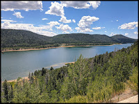
| Navajo Lake where the sinkhole for Cascade Waterfall is on the East Side |
LAVA TUNNEL AT EAST END BY DAM OF NAVAJO LAKE IS WATER SOURCE TO CASCADE WATERFALL
The Cascade Waterfall Trail head is on the Southeast of Navajo lake about 10 miles. Navajo Lake however is a great stop, for it is a beautiful fishing lake that is about 3 miles long and is surrounded by beautiful forested hills. It is stocked with brook and Rainbow trout, and you can actually rent a boat at the lake from Navajo Lake Lodge. It has a trail that loops around the lake, but I have read that it has parts where there are many boulders and that many bikers use the trail.
The Picture below whose the lake and they you can visualize the lava tunnel from there to the red marker where they falls are.
Here is a Google Earth Link.
This lava flow fascinated me, for the more you realize that there is a lava flow area here, the more you watch for it and find it often as you drive around this area. The best main spot is right after you see Navajo Lake there is a small sign on the left side of the road that say Lava Flow. Follow that road in about a half mile, and you will see lava flow for as far as the eye can see.
 |
| Tall Panorama of Cascade Falls |
CASCADE FALLS
360 Trail Cascade Falls from 2018. Both trips were in mid July, so I have no idea why it was quite dry in 2018, and full in 2020. Make sure you rotate it around so you can see everything.
 |
| Lower view area of Cascade Waterfall |
 |
| Tiny Planet Version of Lower view area of Cascade Waterfall |
Cascade Falls is part of the Dixie National Forest.
The hike is a well maintained hike there there are fun steps to keep you safe. I never felt stressed on this trail even though you are up against a cliff often, and there is a sharp drop off on the other side for there is such a well maintained trail here. I also notice in from 2018 to 2020 when I went the second time the trail has had even more improvements made on it. |
| Some of the nice stairs on the Cascade Waterfall Trail |
 |
| Sun Rays over the Beautiful Dixie National Forest and Cascade Waterfall |
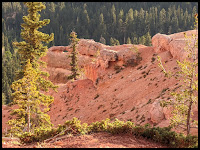
You can see there are beautiful red cliffs off in the distance here
Here is more information from All Trails about this hike.
 |
| Some of the views along the Cascade Waterfall Trail |
Here is one of the nice Scenic Overlooks along the trail. This hike can be hot, so of course take plenty of water.
 |
| Cascade Waterfall Dixie National Forest |
 |
| Red Cliffs along the Cascade Falls trail |
If you liked this area and want to see more, Click on the Cascade Falls Google Earth link below,
Cascade Falls Utah Google Earth
Then click on any Blue line of Dot to see more.
This is utah.com site with the GPS coordinates for the hike.
_____________________________________________
Cool hikes in the area that you should do while you are in the area.
This area surprisingly has some fabulous hikes that surround this waterfall. If you are thinking about heading down to see this waterfall, I would recommend making sure you catch these other great trails while your at it.
Map above has Bryan head in the bottom. The green trail is Hidden Haven. The Red is my trail at Noah's ark where I forgot to turn off my recording. The Purple line is Vermillion Castle.
These Trails are North of Cascade Falls and within an hour drive.
about 30 min north of Cascade (Green Trail)
 |
| Hidden Haven Waterfall |
and Noah's Ark Trail (Red - but only from purple on)
Noah's Ark
Great hike just east of Hidden Haven. If the bridge has not been rebuilt, crossing the stream is easiest down a little ways by the old house. Take hiking sticks if you plan on doing the whole trail, but even just doing a section of this trail is really nice.You can also get great views of Noah's ark that is not quite as treacherous from the great trail across the road from Noah's Ark called Vermillion Castle trail (purple). The only tricky thing about this trail is that it gets a little tricky to find the Cairns, so I would make sure you have an external GPS and the GAIA app map of this area downloaded and start recording when the trail gets a little tricky about 2 miles in. That way you will have a safe trail out.
The map below has Bryan head on the top and shows Bartizan Arch in blue. The light blue section is from Ramparts to the Arch. The Orange trail is Cascade Falls that is below Navajo lake. This map is fun for you can see how far the water has to travel in the lava tunnel before coming out at Cascade Falls.
____
If you liked this hike, you will also LOVE
FAIRYLAND LOOP
and
______________________________________________
RED PINE LAKE
and
__________________________________________
RED LEDGES
and
__________________________________________________
ARCHES BRYCE CANYON
and
________________________________________
WILLIS CREEK SLOT CANYON
and
______________________________________________
RED REEF TRAIL
If you are enjoying my blog, could you take a minute and look at the sponsor links. Any revenue can help me continue to bring fun adventures to you. Thanks! HAPPY HIKING!
Here are a few things that I have gear wise that I will NOT leave home without.
HIKING STICKS
WATERBACK PACK. It is so nice to have quick water whenever you need it while hiking.
My External GPS is a MUST. I don't have much problems getting lost because of this little baby. It is a life saver.
On my wish list, is this handy device that lets you send a text from anywhere through GPS. Super Cool, and the goTenna do not require a service plan. Someday if I make some money off this blogging stuff, I am going to get one of those babies.


