 |
| HorseTail Falls Alpine, Utah Lone Peak Wilderness Area |
HORSETAIL FALLS in 360 Degrees
North Side of Dry Creek River
Alpine, Utah
Video from last year when we found the ultimate view spot.
This week I repeated one of my favorite hikes. Earlier this year, I didn't make it all the way up to the Horse Tail falls, but I made it up this week. It really doesn't matter if you do or do not make it to the falls, for the hike on the North side is so full of amazing views of such a beautiful river that it makes the whole journey delightful. The whole hike (if you stay close to the river on the lower trail) is just picturesque for sound of the river is soothing, and the huge beautiful boulders the river cascades over is grand in nature, and the way the river twists and turns and tumbles makes going around every corner a whole new beautiful view. Not sure who named this canyon Dry Creek, but it is so poorly named, for it is probably the most beautiful river in Utah Valley.
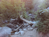
The trickiest part is getting across the river. The State parks does a great job maintaining the trail on the South side of this river, that they don't feel much desire to do anything for the trail on the North side. The problem is the North side trail is 100 times more beautiful that it keeps drawing hikers to the side that is not maintained. You start by heading up EAST of the parking lot on the same trail that heads up the south side of the river, about 1/4 mile up you start watching for trails that head down the mountain on the left. I think there are 2-3 trails that head down. Then follow the trail until you see this bridge below.
 |
| Bridge to North Side of Dry Creek Canyon to Horsetail Falls Lone Peak Wilderness Area |
Above is the bridge from a month and half ago, below is the current bridge. It was sad to see the bridge in disrepair. I wish I had the skills to fix it and I would do it. Anyone game to help?
 |
| Bridge to North Side of Dry Creek Canyon to Horsetail Falls Lone Peak Wilderness Area |
 |
| Dry Creek Canyon that is never "DRY" most poorly named river ever |
The falls is about 2.5-3 miles up the canyon. The problem with this falls is that all the paths I have found down to the falls are a little sketchy and a little scary, and on top of that I have gone up 4 different times, and I watch the trail like a hawk for Carins, and each year I end up at a different spot at the falls.
TOP or HIGHEST SECTION OF HORSETAIL FALLS
When we first came out, we were proud of ourselves for we really had to watch to follow all the Cairns, but we found this spot. It is above the top first waterfall, and is definitely not the spot we found last year. I love my hiking buddy, for she was determined that this is not the spot we need to keep looking for the spot we found last year.
If you look on Google maps you will realize that this falls is actually 3 falls back to back, but at each view point you can't see that there is another one above it or below it.
 |
| Upper Section of HORSETAIL FALLS, ALPINE Utah Lone Peak Wilderness Area |
You can see that we are way up on top to see down to this.
 |
| Upper Section of HORSETAIL FALLS, ALPINE Utah Lone Peak Wilderness Area |
MIDDLE SECTION OF THE DRY CREEK CANYON FALLS
N
This is last year. We found the super awesome spot last year. You would think that doing it so many times I would have this figured out, but it is tricky. I know when we managed to get back up to the trail we were close to an open spot with a fire pit in the middle and the trail headed out the north side of the opening. I know because we didn't see it and we spent a while feeling lost and a little scared until we saw it and felt dumb. |
| Middle Section of the Horsetail Falls Alpine, Utah Lone Peak Wilderness Area |
If you go up the South side there is also a trail that is tricky to find, but you end up where those people are across from us.
This is still a section of the middle falls, but I am right in the middle instead of at the bottom. This is the spot I found 3 times ago 1-2 years ago when I hiked this falls.
LOWEST SECTION OF HORSETAIL FALLS
This is the spot I found this year.
So this is the lowest of the 3 falls.
Each time I fight my way to get out to these falls, it takes a bit of a struggle, and each time I get rewarded with a GORGEOUS view, but it is shocking that I can't seem to find even close to the same spot from year to year.
 |
| Lower Section of Horsetail Falls Alpine, Utah Lone Peak Wilderness Area |
360 sphere of this area, but you need to rotate it around to see waterfalls. If it is not coming in, just click on the BLUE View on Google Maps link.
Here is a link to an article by Herald Extra on this hike. They hiked the South Side, but still the view is Gorgeous in the end.
 |
| View of Mountains on Dry Creek Trail to Horsetail Falls |
 |
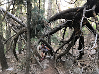
| Spider Tree on Horsetail Dry Creek Canyon Alpine Trail |
Crazy fallen tree we had to crawl under like a tunnel.
 |
| Dry Creek River Alpine, Utah on Hike up to Horse Tail Falls |
Video on River on the way to Horsetail Falls. It is called Dry Creek, but it always is full and beautiful. Not sure who named it, but they were wrong!
Just click below and the video will come up.
 |
| Dry Creek River Alpine Utah or HorseTail Falls Hike from North Side of River |
Another Video of River above Alpine Utah - just click on it, and it will come up.
More Videos of another section of the river that is very pretty.
Just click below and video will come up.Video above is a scenic part of the river. There is a shelter here that was built from logs laying around. Probably to keep a hiker dry when crossing back over the river was looking not too smart in the rain.
The beautiful woods you get to walk through right along side the gorgeous river. I love how the ground is just covered in Pine Needles, and I love the big white rocks. I also like how this area is not a set path, but wander around these rocks beside the river. I just love it.
Sunset makes a gorgeous views of the mountains all lite up to beautiful colors.
Video of the important turn off from the Dry Creek Trail that is EAST of the parking lot. This is the easiest safest way to the trail.
Just click below and video will come up.
If you think you might like this hike, I will reassure you will definitely LOVE the hike along the river. The hike out to the Waterfalls has been stressful for me every time. UGH. But if you would like to see more of this awesome area, click on the HorseTail /Dry Creek Google Earth Link, then click on the little dude in the bottom, then click on any blue line or dot to see more.
HorseTail Falls Dry Creek Canyon River Google Earth Link
___________________________________________
If you liked this hike, you will also LOVE
SCOUT FALLS
and
_______________________________________________
LISA FALLS
and
__________________________________________________
CASCADE FALLS
and
___________________________________________________]
BATTLE CREEK FALLS
and
_____________________________________________________
GROVE CREEK CANYON WATERFALLS
and
______________________________________________________
UPPER PROVO RIVER FALLS
and
____________________________________________________
UPPER FALLS


